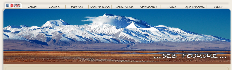
| Information
- MONGOLIA
roads i've cycled so far:
- the
gobi, road from erhenhot (china) or zamyn udd (mongolian side) to ulan baatar
(ub) +/-700km
- a loop in mongolia from
ub erdenet bulgan moron tosonsengel tsetserleg ub+/-2000km
see roadbook below
for details
road conditions:
although some parts of the road tend to be asphalted, it is not
wrong to say that the roads are mainly dirt roads with all the
different possible qualities of dirt roads. in many placees some
work is in progress but mongolian road builders are extremely slow (at least
compared to china) asphalt is mainly around ub and towards russia (suhbaatar)
see road book for details.
visas:
i got my visa in beijing. it cost me 300
yuan for the visa its self (30 euros) plus 200 yuan (20 euros)
for next day service (if you don't want to wait a week) plus
5 yuan for bank fee (you pay in a different place, all explained
in the embassy) for the embassy address i forgot! see lonely planet!
the embassy opens in the morning for visas (monday to friday).
in ub i extended my visa for another month (61 $, payment
in dollars) without any problem despite the fact that i didn't
register in the first 7 days of my arrival (this rule seems to
be over even if you still pay 1250 t to get registered). cyclers
entering from the west of mongolia did not extend their visa for
the time they were on the road till ub and did everything in ub
after over staying their visa over a month, but it would be a good
idea to phone the foreign affair minister from olgi in that case
(sorry, i don't know the phone number). to extend your visa, go
south on the main street from the south west corner of sukhbaatar
square in ub. just before "peace" bridge a road turns
right making a bend. then you can't miss the big white building
on your right.
money/cost:
at the boarder (mongolian
side) 1$ = 1187.7 tougrik (t)
in most of the country you'll have
1$ for 1200 t
in ub you can pay guest houses and tours etc. in
dollars
in ub there is plenty of atm machines (post office for
ex. near sukhbaatar square)
banks change dollars and euros but
best rate was available on the 2nd floor of the "flower corner" (peace
avenue and toiruu intersection, near french embassy)
life in mongolia
is cheap. a meal costs around 1200 to 1500 t (goulash)
accomodation
in ub is around 4-6 $ (gh including free breakfast or free coffee,
depending where)
bike/shop:
in ub there are some spare parts on the
black market but the cheap spare parts are chinese
some tour agencies
may be helpful if you really need something (seven summit in
front of the post office) but at a high price. so globally don't
expect much! out of ub there is nothing!
accomodation:
in ub i stayed in gobi gh situated in the court yard
in front the post office (sukhbaatar square). it was 5$ per night
with free coffee/tea. it is not the cheapest of ub but it have
a kitchen and hot shower, internet (slow) in summer. it is on the
3rd floor but you can park your bike next to the door and it's
safe. many other gh possible in ub, up to you!
map:
i cycled the gobi with just a photocopy of a chinese map that
included this part of mongolia. but then in ub you can find really
good maps.
the "mongolian net work map" was really accurate
and the distances were most of the time good. it is enough for
cycling on main road/track according to me. if you want to get
out of the main road you can also find some good 1/500000 russian
maps at a map shop situated on the west part of peace avenue behind
serge gh. every sheet is 5000t to 7000t. i bought some for my trip
but honestly they are not worth the money for this road nor for
the gobi, but if you plan to get in remote areas they'll be useful
for water finding.
internet facilities:
ub is packed with cyber cafes open 24h a days.
in the post office one works quite well for 600t an hours. taking
the street heading south, opposite the state department store,
there is one on the right hand side (state dep. store in your back)
that has better pcs for 800t. out of ub it will be possible to
find internet in main cities (moron, erdenet, tsetserleg....)
weather:
i had mainly good weather (autumn - mid sept. to mid november)
but some few days of snow. the main concern is the cold and it
may be very coldy at this season with terrible blizzards and wind
(coming from north / north west)
after september you must have
winter gear to cycle there and if you plan to go in winter, be
ready for really cold weather even in the gobi. the north of mongolia
(moron) is terribly cold even in october (it is cooler than tibet
in december) so keep this in mind....
gobi traverse:
a really nice road of about 700km with 500 km
of it unpaved, except the section from choyr to ub. it took me
around 10 days to complete it. on the way north i got some strong
head winds on the last section, fortunately it was paved road.
the water was less a problem than i expected and the road - even
if not always good - was not as bad as i've been told, and pushing
is very seldom needed, except for some short sand patches.
about
the boarder!!!
you're not allowed to cycle the 6 km of no-man-land
between china and mongolia. here how it worked for me:
- on the
way in (to ub): the military threw me in a bus that cost me nothing
except 5 yuan for a kind of toll gate. but the driver wanted to
through me out of the bus after the chinese boarder. but thanks
to mongolian people inside the bus who fought for me i was able
to continue till mongolia without paying.
- on
the way out (from ub) the military (again) threw me in a jeep for
free till the mongolian boarder, where the driver threw me - for
free too - out of the jeep. and then i had to take another jeep
till china that cost me 30 yuan.
no hassle at the boarder its self
but it would be a very bad idea to over stay your visa (85$ fine
for the first day....)
ROAD
BOOKS - information:

distances
the distances are always in kilometers, according
to my speedometer (TOPKEA at the moment) witch is maybe
generous of about 2% compared to the kilometer-markers.
When possible there is the KMM of the road BUT, those kilometer
are not always right either and depending the road, the
distance of the speedometer differes (sometime 2% difference,
sometime 4%, sometimes -2%....). i never tryed to make
the speedometer and KMM distance look the same, i simply
wrote down what i saw on both of them. for the speedometer
i most of the time took the approximate distance, so it
can explain some differences to (for ex 2.3 get 2 or 2.5
exept if i feel it s importante to be precise). the best
to limitated the difference is to use the information location
from location. Some time some small detour (lunch away
from rd, water....) are not off the calcul so this can
also add to the difference in the end. Keep in mind than
it's just indication! although i did my best to make it
as accurated as possible some mistakes may have occured
(writing in the rain, re-typing....). I'm in advance extremely
sorry for this!
altitudes
the watch altitude (sunto vector watch) depends
on the pressure, so the difference with reality can be
important depending the weather. Generally speaking it's
not too bad and will give a good information. For the GPS,
some time it take ages before the "right" altitude
appears, and i m not always patient enough!
GPS
I wrote down what seemed to me the most important
points, but not all the rd due to battery saving as
i really seldom go to hotels.
camping
on some rd i indicated my camp, not that
i think that they are the best place (far from
this!) but 1. it may give an idea of the speed
(note that i'm quite a slow and lazy cycler) and
2. it helps me to make the rd book!!!
road condition
this is not totaly objective! some time in
bad days the rd doesn't look good even if it s asphalt!
so here to give you an idea about my classification:
- asphalt: the best
- good rd: no breaking in down hills
- ok rd: acceptable, you ride without thinking to much of it
- so/so rd: you break in downhill and can't ride without looking at the rd
all the time, and your ass notices it!
- bad rd: means what it means!
- very bad rd: you push your bike...
- corrugated: you'll learn quickly what it means if you don't know yet: stony,
gravel, sandy, muddy....
general
note that i don't write every thing and than things that would
have been important to you at a time were not for me at the same place,
sorry for this. most of all keep in mind that rd condition change as
PSB rules, and that that information is just information.
PSB
when i see a PSB in the region i most of the times mention
it, this means that if you stay in the city and are not suppose to
be there, there is chance that the PSB visits you in the eve or even
in the day. open barrier" means that there was a CP but nobody
cared about me passing it. military CP are generally speaking safe.
abbreviations
EL = electricity line, power line
RW = rail way
TOR = turn off right
TOL = turn off left
X = cross rd
BFB = basic food and beverage
All = hotel, restaurant, shop
@ = internet
CM = chinese pass marker
KMM = kilometers marker
KMS = kilometers speedometer
RRS = road repair station (good water place and some times even more...)
LP = lowest point
Rest = restaurant
ST = straight
CP = check post
R = right
L = left
PSB = "petit salaud en bleu" = problems = police = public security
bureau
Rd = road
TS = truck stop |
|
KMS |
KMM |
alt GPS |
description |
road condition |
GPS point |
-0.6 |
- |
367 |
bus ending (just before train station) ZAMYD
UDD |
- |
N43'43.020
E111'54320 |
0 |
- |
|
train station square (steeple like tower),
rest, shop, hotel, @, around |
asphalt |
N43'43.104
E11'54320 |
+400m |
- |
- |
x = L |
asphalt |
- |
+200m |
- |
- |
X = R (end good asphalt) |
" |
- |
1.4 |
- |
- |
X = st |
poor asphalt |
- |
2.6 (+1.2) |
- |
|
end asphalt, i kept st on the well used track
towards electric lines (EL) at a bearing of 300/310 degrees.
then i followed the EL
|
often corrugated but not to sandy, so/so-
rd
|
N43'43.713
E111'53.168 |
17 (+14.4) |
- |
|
closed water pomp (maybe a water possibility
if the sheepeard is arround) |
better rd on last km |
N43'47.560
E111'44746 |
19.5 (+2.5) |
- |
|
camp |
" |
N43'48.275
E111'43.072 |
24.5 (+5) |
- |
|
tracks reaching other big tracks coming from
east side (X)
little detour away (east from EL (but soon
back along them)
|
so/so- |
N43'49.785
E111'39.829 |
55.5 (+31) |
- |
|
detour away (east) from EL but then back along
them |
ok, rd as average |
N43'58.826
E111'21.847
|
57 (+1.5) |
- |
|
well (water) |
" |
N43'59.405
E111'21.299
|
72.5 (+15.5) |
- |
|
reaching main track (i guess) which was east
of the track that i was on (on the EL so) |
ok rd |
N44'04.472
E111'13.514
|
74 (+1.5) |
- |
|
camp being metalic hut (closed), 100m east
of rd |
ok- rd |
N44'04.693
E111'12.774
|
79 (+5) |
82/136 |
|
cafe (possible food) |
ok rd |
N44'06.087
E111'09.478
|
98 (+19) |
99/119 |
|
tracks crossing EL (it was west of them) |
" |
N44'13.900
E111'05.262
|
102.5 (+4.5) |
- |
|
TO west for houses (water, 500m) |
so/so rd (first sandy then corrugated) |
N44'16.222
E111'04.839
|
114 (+11.5) |
- |
|
crossing EL after an eastern detour + reaching
tracks that were more west than the one i was on |
- |
N44'19.122
E110'59.825
|
119 (+5) |
- |
|
well (500m east rd) = dry in september, step
downhill before |
ok rd |
N44'20.209
E110'56.845
|
131.5 (+12.5) |
- |
|
village, water (don't expect much more)
is
this Ulan Uul? (i m not sure) |
ok rd |
N44'25.836
E110'52.342
|
134 (+2.5) |
- |
|
X = R (east) but st should work too, and maybe
shorter) |
ok rd |
N44'26.274
E110'51.029
|
137 (+3) |
- |
|
camp |
ok- rd |
N44'27.844
E110'50.118
|
142 (+5) |
- |
|
X = st (reaching track arriving from west
side |
ok - rd |
N44'28.982
E110'47.086
|
153.5 (+11.5) |
- |
|
work for about 10km (well advenced), worker-camp
and water |
" |
N44'32.967
E110'41.453
|
175 (+21.5) |
- |
|
crossing EL (they were east of the tracks) |
ok rd |
N44'41.314
E110'32.379
|
186 (+11) |
- |
|
well = water |
" |
N44'45.310
E110'27.294
|
192 (+6) |
- |
|
reaching rail way (RW) + hamlet (few houses,
500m east of the track) |
" |
N44'46.972
E110'23.816
|
199.5 (+7.5) |
- |
|
worker-camp |
" |
N44'48.849
E110'19.202
|
207 (+7.5) |
- |
|
camp |
" |
N44'51.291
E110'15.000
|
216.5 (+9.5) |
- |
|
reaching asphalt rd, i was on a track passing
next to electric power station (SE)
just before crossing
RW and near an Petrole station
(the new rd will be east of
Shainshand city)
|
ok rd |
N44'53.931
E110'09.467
|
217 (+0.5) |
- |
|
X (board with distance A33A....)
L = towards
city and red Petrol station
|
asphalt |
N44'53.983
E110'09.181
|
218.5 (+1.5) |
- |
|
telecom office + @ + shops = city center on
a east/est rd
reaching 300m later a big X with police and
post office (second GPS point) where i took R = North (up,
towards a tank monument (ank on a plinth)
|
" |
N44'53.566
E110'08.415
N44'53.504
E110'08.187
|
221 (+2.5) |
- |
|
X = L (north) for UB (few houses arround,
like a second part of town), end asphalt soon after |
" |
N44'54.772
E110'08.338
|
223 (+2) |
- |
|
rd turn north (R), would have been better
to short cut just after the end of asphalt towards a green
building |
so/so |
N44'54.930
E110'07.104
|
224 (+1) |
- |
|
crossing RW, then choose one of the many tracks
heading NNW along RW few hundred meters east of it) |
" |
N44'55.301
E110'07.304
|
+/-237 (+/-13) |
- |
|
board +"bhuddist monument" |
so/so- rd (sandy) |
N45'01.667
E110'05.050
|
251 (+14) |
- |
|
large pond (not drinkable) |
so/so- rd (sandy and corrugated) |
N45'07.697
E109'59.808
|
254.5 (+3.5) |
- |
|
hamlet on RW + work-camp |
ok rd using the half done rd (no asphalt) |
N45'09.174
E109'58.160
|
267.5 (+13) |
- |
|
camp |
new rd not cycle on the last 2km (sept 2007) |
N45'14.581
E109'52.666
|
279.5 (+12) |
- |
|
hamlet on RW |
ok- rd (track a bit west of EL) |
N45'19.574
E109'47.047
|
291.5 (+12) |
- |
|
yourte and mast |
so/so track corrugated (along EL) |
N45'24.662
E109'42.236
|
314 (+22.5) |
- |
|
ruins east EL (nothing there)
i first stayed
along EL, they in between EL and RW then back to EL just
before this ruin
i've seen many cars on the west side of
the RW (maybe better???)
|
quite bad tracks (sandy and corrugated) |
N45'34.707
E109'34.966
|
321.5 (+7.5) |
- |
|
hamlet on RW |
ok tracks along EL (east RW) |
N45'38.348
E109'33.528
|
337 (+15.5) |
- |
|
locked crossing + camp |
so/so rd (corrugated) |
N45'44.768
E109'26.874
|
338 (+1) |
- |
|
big hamlet on RW |
ok rd |
N45'44.971
E109'26.441
|
347.5 (+9.5) |
- |
|
crossing RW (be carefull, there are 2 branchs
on the RW, this one is the one heading toward west)
from
there you can see Airag (Tsagaandorvolj) on the west, i head
for it
|
quite bad for the first 6km(corrugated) then
so/so |
N45'47.875
E109'20.726
|
350.5 (+3) |
- |
|
AIRAG train station (green) (entering from
the east i had to cross the whole village)
few shops and
water
i left Airag along the RW (east side)
|
so/so (corrugated) |
N45'48.090
E109'18.466
|
376 (+25.5) |
- |
|
DALANJARGALAN water kiosk (little out of village)
few shops
leaving village, possible crossing i think for
a village on the other side of Rw, i kept st along east side
of the RW
|
so/so- rd (corrugated sandy stony!!!) |
N45'55.188
E109'03.680
|
386 (+10) |
- |
|
TSOMOG
few shops and water kiosk
just before it X with possible crossing
toward the coal mine (only?) i kept st toward the village
leaving it heading a bit away of RW toward EL east
|
ok rd first then so/so- rd (corrugated) |
N45'57.147
E108'57.134
|
390 (+4) |
- |
|
camp |
ok rd |
N45'58.776
E108'55.087
|
400.5 (+10.5) |
- |
|
hamlet on RW
the track i was on was in between
RW and EL first, then back to RW
Marc and Ju said there was
a good track along EL
|
ok- track last km is corrugated |
N46'00.876
E108'48.272
|
420 (+19.5) |
- |
|
hamlet on RW (on the west side of RW further
West there is something looking like a town) |
so/so rd corrugated with sandy patch |
N46'08.309
E108'39.517
|
436.5 (+16.5) |
- |
|
houses with mast
just before was a big coal
mine just west of the track i was on
|
so/so (corrugated) |
N46'14.801
E108'31.556
|
440 (+3.5) |
- |
|
X, reaching a "look like main track" track
coming from my west side (passing the other side of the mine),
board in cyrillic |
so/so rd |
N46'16.166
E108'29.583
|
443.5 (+3.5) |
- |
- |
big building west of tracks |
" |
- |
447.5 (+4) |
442/231 |
|
reaching new rd asphalt!!! near whites houses
east RW and east 2 big EL |
" |
N46'19.021
E108'26369
|
454 (+6.5) |
- |
|
X with 3 petrol stations
st = UB
R = water near buildings
L = Choyr (hotel+shops)
|
asphalt |
N46'21.223
E108'22.880
|
456 (+2) |
- |
- |
CP (nothing) |
" |
- |
463.5 (+7.5) |
- |
|
camp |
" |
N46'26.083
E108'20.937
|
476.5 (+13) |
470/203 |
- |
TOR for small town |
" |
- |
478.5 (+2) |
472/201 |
- |
crossing Rw (not the main one to UB) |
" |
- |
479.5 (+1) |
473/200 |
- |
hamlet on RW+PS |
" |
|
482 (+2.5) |
475/198 |
- |
" |
" |
- |
506.5 (+24.5) |
499/174 |
|
hamlet on RW (+ 2km as well) |
" |
N46'43.054
E108'02.010
|
530.5 (+24) |
522/151 |
- |
house (cafe?) along the rd, hamlet on RW |
" |
- |
533.5 (+3) |
525/148 |
- |
hamlet on RW |
" |
- |
557.5 (+24) |
548/125 |
|
" |
" |
N47'02.639
E107'38.775
|
564.5 (+7) |
555/118 |
- |
rest |
" |
- |
583.5 (+19) |
573/100 |
|
MAANT all + PS |
" |
N47'15.141
E107'32.487
|
586 (+2.5) |
- |
- |
crossing a RW branch (heading east) |
" |
- |
594.5 (+8.5) |
584/89 |
- |
" |
" |
- |
595.5 (+1) |
585/88 |
- |
TOL (west) for village (BACHANGA?)+PS |
" |
- |
598 (+2.5) |
- |
|
camp |
" |
N47'22.246
E107'28.913
|
608/609 (+10/11) |
597/76-598/75 |
- |
hamlet/village |
" |
- |
628 (+19) |
616/57 |
|
highest point (pass) |
" |
N47'35.251
E107'18.528
|
634.5 (+6.5) |
- |
|
village (water) |
" |
N47'36.838
E107'14.276
|
637 (+2.5) |
- |
- |
camp (i never had such a head wind in my life...) |
" |
- |
645.5 (+8.5) |
633/40 |
- |
toll gate + village |
" |
- |
654.5 (+9) |
642/31 |
|
X = L (st) for UB (R = Nalayth)
big ball in
middle of X
|
" |
N47'46.657
E107'13.932
|
656.5 (+2) |
- |
- |
X = st (R for Nalayth)
PS + police
|
poor asphalt |
- |
673 (+16.5) |
- |
|
tool gate/CP
rest arround
|
" |
N47'53.275
E107'04.261
|
676 (+3) |
- |
|
X = st for UB
R = GACHUURT
|
" |
N47'54.035
E107'02.097
|
681 (+5) |
- |
|
round about i took R |
" |
N47'54.746
E106'58.660
|
681.5(0.5) |
- |
|
roundabout, i took left (statue with planes
in middle) |
" |
N47'54.951
E106'58.345
|
684 (+2.5) |
- |
|
big X = st and always st afterward (it's Enkh
Taivny Orgon Choloo = peace avenue) |
" |
N47'55.155
E106'56.607
|
686 (+2) |
- |
|
SUKHBAATAR Square = main square of UB
end
of ride!!!!
|
" |
N47'55.023
E106'54.985
|
Ub - ub tour via erdenet bulgan moron tosontsengel
- tsetserleg
An almost 2000km trip that took me a month cycling.
the first part
till bulgan is on paved road, the rest except some kilometers at
the end is dirt road.
on your way west you'll get head wind, but
as it's a loop, it's fair with you on the way back to ub :)
i did
the loop in this sens as i was hurried by the winter, and the north
of mongolia is extremely cold, even in october!
| KMS |
KMM |
alt watch |
alt GPS |
description |
rd condition |
GPS point |
0 |
0 |
- |
|
gobi guest house just in front of the post
office (5 dollars) |
- |
N47'54.988
E106'54.752 |
8.5 |
- |
- |
|
X = L crossing RW
till there always straight on peace avenue towards west |
asphalt and traffic |
N47'54.574
E106'48.127 |
16 (+7.5) |
- |
- |
|
tool gate |
asphalt narrow |
N47'54.044
E106'42.866 |
20 (+4) |
19/326 |
- |
|
X = st for SUHBAATAR, DARHAN, DAYANGUL
(R = ARVAYER, TSETSERLEG and west mongolia)
supermarket |
asphalt |
N47'53.948
E106'40.183 |
29 (+9) |
- |
1430 |
|
small pass |
" |
N47'57.361
E106'36.435 |
35.5 (+6.5) |
34/311 |
1280 |
|
tool gate + PS+ TOR (east) for village |
" |
N47'59.933
E106'32.905 |
39 (+3.5) |
- |
1285 |
- |
TOL |
" |
- |
52 (+13) |
- |
1400 |
- |
TOL for village |
" |
- |
54 (+2) |
- |
- |
|
camp |
" |
N48'07.778
E106'25.725 |
54.5 (+0.5) |
- |
1510 |
|
pass |
" |
N48'08.065
E106'25.500 |
59 (+4.5) |
56/289 |
1350 |
- |
LP + TOR (East) for tourist camp |
" |
- |
69 (+10) |
66/279 |
- |
|
small town (BAYANCHANDMANI)
PS rest |
" |
N48'13.240
E106'17.960 |
92 (+23) |
89/256 |
1025 |
- |
rest/shop + river |
" |
- |
99.5 (+7.5) |
- |
950 |
- |
rest |
" |
- |
101 (+1.5) |
97/248 |
980 |
|
TOR (east) for BORMUUR |
" |
N48'27.399
E106'12.732 |
104 (+3) |
100/245 |
1015 |
|
village rest PS |
" |
N48'28.330
E106'11.069 |
111 (+7) |
- |
1100 |
- |
mini pass |
" |
- |
117 (+6) |
112/233 |
1005 |
- |
TOL (W) JARGALANT |
" |
- |
118.5 (+1.5) |
- |
1000 |
- |
camp |
" |
- |
126.5 (+8) |
- |
1085 |
|
small pass |
" |
N48'38.738
E106'05.473 |
138.5 (+12) |
- |
1050 |
- |
top climb |
" |
- |
161.5 (+23) |
- |
720 |
|
BAYANGOL small town, rest shop PS |
" |
N48'54.791
E106'05.001 |
178 (+16.5) |
- |
700 |
- |
camp L rd (water few km before in a small
shop/rest) |
" |
- |
190 (+12) |
- |
850 |
|
top climb (hotel???) |
" |
N49'08.735
E106'02.593 |
211 (+21) |
203/142 |
540 |
|
KHONGOR (HONGOR) small town rest PS shop |
" |
N49'18.346
E105'56.169 |
220.5 (+9.5) |
212/133 |
515 |
|
TOL (W) for ERDENET (168km on board)
(St = DARKHAN and russia)
(fill up water there if it's late...) |
" |
N49'22.738
E105'54.979 |
227 (+6.5) |
- |
550 |
|
camp |
" |
- |
251 (+24) |
41/139 |
680 |
|
NOMGON small village (water) |
" |
N49'11.781
E105'40.333 |
265 (+14) |
54/126 |
715 |
|
HOTOL (100m left of rd) PS + rest along the
rd |
" |
N49'06.344
E105'33.094 |
280 (+15) |
69/111 |
565 |
- |
rest PS river |
" |
- |
283 (+3) |
72/108 |
- |
- |
main river bridge rest and TOR for SANT and
AMARBAYASGALANT monastery |
" |
- |
290 (+7) |
- |
- |
- |
camp left rd |
" |
- |
313 (+23) |
101/79 |
820 |
- |
TOR for AMARBAYASGALANT monastery |
" |
- |
326.5 (+13.5) |
114/66 |
800 |
- |
village(L) + PS
river just after |
" |
- |
347.5 (+21) |
136/44 |
1200 |
|
small pass
steep for 3km |
" |
N49'05.072
E104'36.631 |
352 (+4.5) |
- |
1045 |
- |
camp right above rd |
" |
- |
365.5 (+13.5) |
151/29 |
960 |
|
CP (police) + TOR for JARGALANT (small town)
+ PS |
" |
N49'03.520
E104'24.663 |
383 (+17.5) |
168/12 |
- |
|
TOR for HANGAL + CP + PS |
" |
N49'04.593
E104'11.571 |
393 (+10) |
178/2 |
1230 |
|
X (light) R = ERDENET center
(st = ring rd would have been shorter and there is shop and petrole on
it) |
" |
N49'01.969
E104'04.937 |
396 (+3) |
- |
1270 |
|
ERDENET main square (all but detour + super
market - note especially for lonely cyclers as you have to
let the bike alone)
always st in city till main square then rd zigzaging before going down
towards ring rd |
" |
N49'01.677
E104'02.781 |
400 (+4) |
2/51 |
1270 |
|
back ring road, on board BULGAN 53 Moron 403 |
" |
N49'00.745
E104'01.087 |
435 (+35) |
- |
1285 |
|
dirty river (bridge) house |
" |
N48'53.790
E103'39.919 |
436 (+1) |
- |
- |
- |
camp L rd |
" |
- |
437.5 (+1.5) |
+/-39/14 |
1400 |
|
pass 1st summit |
" |
N48'53.681
E103'37.646 |
438.5 (+1) |
- |
1400 |
|
pass 2nd summit |
" |
N48'53.544
E103'37.090 |
453 (+14.5) |
- |
1090 |
|
BULGAN (entrance) shop + PS
X = R for MORON (end nice asphalt)
(L for bulgan center) |
" |
N48'49.393
E103'31.223 |
458 (+5) |
- |
1160 |
- |
end asphalt |
poor asphalt |
- |
467 (+9) |
- |
1265 |
|
small dirty stream |
main track looked stony, i cycle R (east)
of it on ok + tracks
(2 tracks join there) |
N48'53.654
E103'22.976 |
482.5(15.5) |
- |
1150 |
- |
rd turn west (rest) + river |
mainly ok
(new rd under construction) |
- |
485 (+2.5) |
- |
- |
- |
abandonned house = camp |
- |
- |
498.5 (+13.5) |
- |
1360 |
- |
small rest |
ok rd (often stony on main rd, 2nd better) |
- |
501.5 (+3) |
- |
1480 (adjust to 1665!!!!, GPS+map) |
|
pass, BFB + rest |
so/so rd (stony) |
N48'56.907
E103'02.923 |
507.5 (+6) |
- |
1540 |
- |
village + rest + BFB + PS |
ok-rd |
- |
517 (+9.5) |
- |
1535 |
|
X = R along EL |
" |
N48'56.304
E102'51.835 |
519 (+2) |
- |
1510 |
- |
rest (followed wodden EL first then main EL) |
ok rd |
- |
527 (+8) |
- |
1385 |
|
back main track witch was coming from my R
(east) |
ok rd if not muddy |
N48'59.883
E102'48.023 |
537 (+10) |
- |
1255 |
- |
camp in cold valley |
ok rd |
- |
544 (+7) |
- |
1160 |
|
small river crossing |
ok rd |
N49'08.006
E102'48.847 |
545 (+1) |
- |
1165 |
|
UNIT village BFB |
- |
N49'08.606
E102'48.907 |
557.5 (+12.5) |
- |
1055 |
|
river (bridge) |
ok rd (stony at the end) |
N49'12.932
E102'55.589 |
567 (+9.5) |
- |
990 |
- |
small river (bridge) |
so/so rd (stony) |
- |
583 (+16) |
- |
905 |
|
big bridge over SELENGE river + rest just
before |
ok rd sandy patch at the end |
N49'22.987
E102'50.603 |
587.5 (+4.5) |
- |
1020 |
|
mini pass |
ok rd |
N49'23.561
E102'48.264 |
595.5 (+8) |
- |
930 |
|
HUTAGONDOR shop, rest, water, kiosk,
getting out of the city heading N toward 2 PS and a rest, then W along
wooden EL |
- |
N49'23.559
E102'42.238 |
604.5 (+9) |
- |
- |
- |
camp |
ok+rd |
- |
616.5 (+12) |
- |
1065 |
|
bridge + river |
ok rd if not muddy |
N49'30.085
E102'29.604 |
628.5 (+12) |
- |
1220 |
- |
river |
so/so rd (stony) |
- |
630.5 (+2) |
- |
1235 |
- |
river |
- |
- |
639.5 (+9) |
- |
1405 |
|
mini pass (abandonned house in oct) |
ok rd (if not muddy) |
N49'32.107
E102'12.610 |
644.5 (+5) |
- |
1310 |
- |
rest |
ok rd |
- |
658.5 (+14) |
- |
1130 |
- |
dirty river (not drinkable for me) |
ok+rd |
- |
664.5 (+6) |
212/141 |
1095 |
|
village, rest, BFB, PS
TOR for TARIALAN |
ok rd |
N49'32.078
E101'53.047 |
666.5 (+2) |
- |
- |
- |
camp (I haven't seen the TO for TESHIG, maybe
4km after my camp and TO for TARIALAN not clear either, maybe
one after the minin pass) |
- |
- |
678.5 (+12) |
- |
1370 |
|
3rd summit of a pass |
ok- rd (end so/so) |
N49'28.625
E101'43.050 |
682 (+3.5) |
229/124 |
1240 |
- |
LP + river |
ok rd |
- |
684.5 (+2.5) |
- |
1380 |
- |
pass |
so/so+ rd |
- |
697.5 (+13) |
242/111 |
1180 |
|
PS + TOL for INUUL |
so/so- rd (very stony end better but corrugated) |
N49'27.334
E101'28.825 |
703 (+5.5) |
- |
1180 |
|
TOR for Zuun mergeny davaa (?) |
so/so rd |
N49'27.768
E101'24.987 |
706.5 (+3.5) |
- |
1140 |
- |
rest |
so/o rd |
- |
714.5 (+8) |
- |
1230 |
- |
top climb + X = st (L along EL) |
so/so+ rd 1st then ok |
- |
719.5 (+5) |
- |
1190 |
- |
camp near abandonned house (FOR WINTER) |
ok rd |
- |
748 (+28.5) |
288/65 |
1335 |
|
TOSONTSENGEL village BFB, rest, PS |
stony first, then better, then sandy and corrugated! |
N49'28.575
E100'53.852 |
770.5 (+22.5) |
310/43 |
1550 |
|
bridge + river
(arround 11km before the valley branch with track in both sides the northen
one (R) is the main one for MORON) |
ok- rd |
N49'34.522
E100'41.015 |
781.5 (+11) |
- |
1710 |
- |
camp just before pass |
ok- rd |
- |
784.5 (+3) |
324/29 |
1815 |
|
pass |
ok rd |
N49'38.789
E100'31.804 |
793 (+8.5) |
332/21 |
1825 |
|
2nd pass (2km down after first pass towards
lake = so/so rd) |
ok rd |
N49'38.255
E100'26.229 |
802.5 (+9.5) |
- |
1610 |
- |
asphalt start! |
ok rd |
- |
814 (+11.5) |
- |
1390 |
|
MORON, X (round about) with MINI cafe = st
for main street of moron (stayed in TURST HOTEL for 5000
Tougrik with hot shower, not so great
300m straight after mini cafe (GH arround there as well) |
asphalt |
N49'38.223
E100'09.594
(X near DUL hotel) |
820.5 (+6.5) |
- |
1280 |
|
bridge just after X = R |
so/so+ rd |
N49'35.088
E100'09.105 |
867 (+46.5) |
- |
1385 |
|
BURENTOGTOH village, BFB, rest
turn left in it toward a pass (steep) |
so/so rd (good part as well as bad) |
N49'37.125
E099'35.369 |
870 (+3) |
- |
1500 |
- |
camp in way up (not great) |
ok rd but steep |
- |
871 (+1) |
- |
1590 |
|
pass |
ok rd steep |
N49'35.906
E099'32.766 |
882.5 (+11.5) |
- |
1390 |
- |
small rest (closed in oct) |
so/so+ |
- |
892.5 (+10) |
- |
1680 |
|
top 4 km climb |
so/s0+ rd, steep end |
N49'32.420
E099'18.961 |
906 (+13.5) |
- |
1525 |
|
BURENHAAN, BFB
(the track for TSAGAAN UUL is the one heading a bit NW after crossing
a small river it follow some wooden EL) |
1st ok then so rd |
N49'29.767
E099'09.292 |
911.5 (+5.5) |
- |
1795 |
|
top climb |
ok rd |
N49'30.738
E099'05.343 |
915.5 (+4) |
- |
1785 |
- |
camp |
ok rd |
- |
929.5 (+14) |
- |
2080 |
- |
pass???? (many small climbs) |
ok rd |
- |
|
930 (+0.5)
|
-
|
2030
|
|
sream running in oct (3km before another stream but icy)
|
ok rd
|
N49'33.585
E098'52.503
|
935 (+5) |
- |
1975 |
|
track branch
R = toward TSAGAAN UUL
(i took st/L = short cut) |
ok rd |
N49'33.081
E098'48.777 |
940 (+5) |
- |
1920 |
|
X = st (west) |
'' |
N49'32.350
E098'45.198 |
943.5 (+3.5) |
after 119/269 |
1915 |
|
X = st (other track L) |
'' |
N49'32.099
E098'42.411 |
945.5 (+2) |
- |
1930 |
|
bridge (icy river in oct) |
ok rd |
N49'31.764
E098'40.876 |
946.5 (+1) |
- |
1925 |
|
reaching track from TSAGAAN UUL (from R, NE)
rd turn south |
ok rd |
N49'31.745
E098'40.458 |
962.5 (+16) |
- |
1965 |
|
X = R (there is a lake 1km south, you can't
see it from the rd
(L = OVGODIYNZUSIAN) |
ok rd |
N49'26.867
E098'30.325 |
972.5 (+10) |
- |
2050 |
|
pass |
ok rd |
N49'25.257
E098'23.069 |
996.5 (+24) |
- |
1895 |
|
water (left road starting river) |
ok+ rd |
N49'17.225
E098'10.806 |
999.5 (+3) |
- |
1885 |
|
bridge+running water in oct |
" |
N49'16.230
E098'08.679 |
1010.5 (+11) |
- |
2045 |
|
top climb |
so/so+ rd (sandy or stony) |
N49'12.643
E098'02.737 |
1019.5 (+9) |
- |
2025 |
|
bridge + river (almost frozen in oct)
just after SOGOUT village
kust after bridge TOR for a Tsetserlg village (not the big city in central
mongolia) - keep up (left) in valley) |
ok rd |
N49'09.070
E097'58.478 |
1024.5 (+5) |
- |
2155 |
- |
camp above rd |
ok rd |
- |
1036.5 (+12) |
- |
2335 |
|
pass |
ok rd |
N49'00.415
E097'56.280 |
1041.5 (+5) |
- |
2065 |
|
X = L in valley
water in valley
(R may be ok , upper valley side, W side) |
ok rd |
N48'58.125
E097'55.429 |
1046.5 (+5) |
- |
2010 |
- |
reaching upper track |
ok - rd |
- |
1053.5 (+7) |
- |
1950 |
|
I took L (SE) on E side of valley (seem to
be a short cut)
(R on west side of valley = longer you'll reach a crossrd for NOMROG) |
ok rd |
N48'52.245
E097'55.512 |
1061.5 (+8) |
- |
1905 |
|
re reaching main track, X = L for TOSONTSENGEL
(R for NOMROG and TELMEN) |
sandy short cut! |
N48'48.336
E097'56.539 |
1074 (+12.5) |
- |
2115 |
|
pass, rest just before pass |
sandy first in lower part then ok |
N48'49.011
E098'06.194 |
1085.5 (+11.5) |
- |
1915 |
|
camp (before another pass) |
ok-rd |
- |
1086.5 (+1) |
- |
1960 |
|
mini pass (2 rd one direct and another one
less steep) |
ok rd |
N48'47.135
E098'14.428 |
1090.5 (+4) |
- |
1825 |
|
+/- city center TOSONTSENGEL (all+@ sign)
near MT PS, and foot ball ground WITH shop and rest arround.
but best food street just behind (east)
entering the city = many different track i head for the big white building.
there are 2 ways for UB from here. one southern one toward the airport
after a bridge (main one on the 1/500000 map but not in reality).
one heading west from the PS station or the food street (rd along the
main river but from the city don't head directly towards the river, i
took this one.) |
ok rd |
N48'45.564
E098'15.689
N48'44.744
E098'16.208
(bridge for the sourthen rd) |
1093.5 (+3) |
- |
1860 |
- |
out city |
ok rd |
- |
1126 (+32.5) |
- |
- |
- |
camp along river |
often sandy rd |
- |
1133.5 (+7.5) |
- |
- |
|
IN UUL
X at entrance = st toward red PS (L for village)
heading toward bridge and river (L after bridge) |
ok rd |
N48'42.831
E098'47.898 |
1155 (+21.5) |
- |
1745 |
|
changing valley up south |
ok rd |
N48'38.133
E099'01.090 |
1170 (+/-15) |
- |
1915 |
- |
village (probably rest in summer) |
" |
N48'30.870
E098'53.551 |
1175 (+/-5) |
- |
1975 |
- |
" |
" |
- |
1177 (+/-2) |
198/271 |
2015 |
- |
'' |
" |
- |
1183 (+/-6) |
- |
2110 |
- |
camp |
" |
- |
1190.5 (+7.5) |
- |
2280 |
- |
rest |
ok+ rd |
- |
1192.5 (+2) |
- |
2320 |
- |
" |
" |
- |
1199 (+6.5) |
219/250 |
2705 |
|
pass (just 5km steeper) SOLONGOTIYN DAVAA |
" |
N48'17.454
E098'57.507 |
1228 (+29) |
- |
2260 |
|
TSAHIR village 500m R
PS/rest along rd |
ok+ rd (good just after pass) |
N48'06.321
E099'08.594 |
1246.5 (+18.5) |
- |
2220 |
|
bridge + river + rest
dogs! |
ok+rd |
N48'03.666
E099'21.481 |
1262 (+15.5) |
- |
- |
- |
village (TSAGAANNUUR), rest, BFB |
ok- rd (2nd better) |
- |
1263 (+1) |
- |
- |
- |
camp |
ok rd |
- |
1291.5 (+28.5) |
- |
2115 |
|
TARIAT rest BFB PS on rd side
TOL for center (@)
(also 4km before TOL for TARIAT center) |
ok- rd with good 2nd with one bad section
of 5 km before the first TO for tariat |
N48'09.082
E099'53.784 |
1330 (+38.5) |
- |
1895 |
|
village + rest + river |
good 2nd road |
N48'05.640
E100'19'157 |
1341.5 (+11.5) |
- |
1920 |
|
river + village |
" |
N48'01.335
E100'25.003 |
1344.5 (+3) |
- |
1920 |
- |
camp in abamdonned house for winter |
ok rd |
- |
1360.5 (+16) |
- |
2065 |
|
pass (one rest/yourte on the way)
HALZANGIYIN DAVAA |
ok+rd |
N47'56.642
E100'36.557 |
1379.5 (+19) |
- |
1815 |
- |
DONGOY (rest + PS)
from there 2 rd one L (NE) witch is the maun rd (lOOKed stony)
st = one short cut one good track BUT no bridge on the river (in late
oct totaly icy no pb) |
ok rd |
- |
1400 (+20.5) |
- |
1925 |
|
houses = BORT (rest close in late oct) |
good rd on short cut |
N47'43.255
E100'57.702 |
1429.5 (+29.5) |
- |
1590 |
|
bridge and river
1km before IHTAMIR: small town N of rd
after bridge = START ASPHALT |
mainly good rd (using nearly completed new
rd without asphalt or 2nd rd)
|
N47'35.089
E101'12.883 |
1439.5 (+10) |
- |
1600 |
- |
camp in small house L rd |
asphalt |
- |
1444.5 (+5) |
- |
1640 |
- |
end asphalt |
" |
- |
1448.5 (+4) |
- |
1920 |
|
pass, one river on way up |
ok+ rd but steep |
N47'30.154
E101'24.994 |
1453.5 (+5) |
- |
1670 |
|
asphalt back + TOL for TSETSERLEG center (one
TOR before for BULGAN
(yes often same name in mongolia!!!)
good water on the way down before city |
ok + rd first then ok |
N47.28.380
E101'26.823 |
1479.5 (+26) |
- |
1520 |
|
village (TSENHER) BFB PS+ rest (all close
late oct) |
end asphalt arround 16km after tsetserleg
then good rd
(possible asphalt soon from there) |
N47'26.925
E101'45.700 |
1533.5 (+54) |
- |
1520 |
- |
asphalt back for 1km |
ok+rd |
- |
1539.5 (+6) |
- |
1425 |
- |
HOTONT (rest, shop)
bridge + river just after |
ok+rd |
- |
1546 (+6.5) |
- |
1490 |
- |
night in ger |
" |
- |
1560 (+14) |
- |
1465 |
- |
asphalt back |
ok rd |
- |
1562.5 (+2.5) |
- |
1495 |
- |
rest |
asphalt |
- |
1564 (+1.5) |
- |
- |
- |
end asphalt |
asphalt |
- |
1567 (+3) |
- |
1520 |
- |
asphalt back |
ok rd |
- |
1576 (+9) |
- |
1500 |
|
HARHORIN town = all
X = st for UB (L+ HASHAAT) |
asphalt |
N47'11.651
E102'48.589 |
1579 (+3) |
- |
1525 |
- |
X = st out of city
(1 GH just before) |
" |
- |
1591 (+12) |
14/348 |
1585 |
|
X = L for UB
(st = HUJIRT) |
" |
N47'07.694
E102'57.382 |
1593 (+) |
17/345 |
1555 |
- |
river + rest + Toll gate 1km after |
" |
- |
1617 (+24) |
40/322 |
1550 |
- |
rest (close) |
'' |
- |
1654.5 (+37.5) |
- |
1330 |
|
X = L for UB (rest hotel there)
(R = ARVAYHEER) |
'' |
N47'18.303
E103'38.296 |
1658 (+3.5) |
- |
1325 |
- |
camp |
'' |
- |
1670 (+12) |
- |
1500 |
- |
rest (close late oct) |
'' |
- |
1680 (+10) |
172/259 |
1470 |
|
RASHAANT, PS rest shop next to the rd
TOL for city center
several tourist camp on the way (all close late oct) |
'' |
N47'22.088
E103'56.390 |
1722 (+42) |
213/218 |
1465 |
|
rest shop PS
ERDESANT rd side
city center few km south |
" |
N47'20.376
E104'28.846 |
1744 (+22) |
235/196 |
1370 |
- |
rest |
'' |
- |
1785 (+41) |
- |
1220 |
- |
night in ger |
'' |
- |
1807 (+22) |
- |
- |
|
TOL for BAYANNUUR
rest + bridge and river just after |
'' |
N47'51.440
E105'11.135 |
1813 (+6) |
- |
- |
|
LUn village all |
'' |
N47'51.965
E105'15.129 |
1819 (+6) |
- |
- |
- |
end asphalt (but work on progress) |
'' |
- |
1841 (+22) |
- |
1055 |
|
TOL for BAYANHANGAY
rest shop hotel |
ok+ 2ndary rd |
N47'54.548
E105'35.203 |
1857.5 (+16.5) |
- |
1170 |
|
PS + rest (close in late oct) |
ok 2ndary rd |
N47'52.759
E105'47.447 |
1866.5 (+9) |
- |
- |
- |
rest |
- |
- |
1874 (+7.5) |
- |
- |
- |
night in ger |
- |
- |
1894.5 (+20.5) |
- |
1215 |
|
rest + PS |
ok+ 2ndary rd |
N47'54.992
E106'15.241 |
1899 (+4.5) |
- |
1335 |
|
rest + CP |
" |
N47'54.879
E106'18.621 |
1918 (+19) |
- |
1385 |
|
top climb
asphalt back
rest + PS and long village just after |
'' |
N47'54.387
E106'32.689 |
1930 (+12) |
19/326 |
- |
|
X back to the X on km 20 of this rd book
R for UB (L = rd for russia) |
asphalt |
N47'53.948
E106'40.183 |
1949 (+19) |
- |
- |
|
UB center, gobi GH (in front of post office,
5 $ per night) |
|
N47'54.988
E106'54.752 |
|